
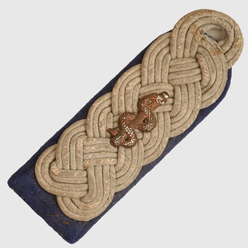
GERMAN WWII ARMY MEDICAL MAJOR’S SHOULDER BOARD.
A single stitch-on shoulder board for a Medical Major. Subdued grey army lace on a blue base with medical motif to the centre. Recently purchased from probably the best combat uniform and equipment collection in the United Kingdom comprising Army tropical, Waffen SS, Luftwaffe paratrooper and many other items of the same genre. The collection was begun by the then 15 year old boy who used to vi... read more
65.00 GBP
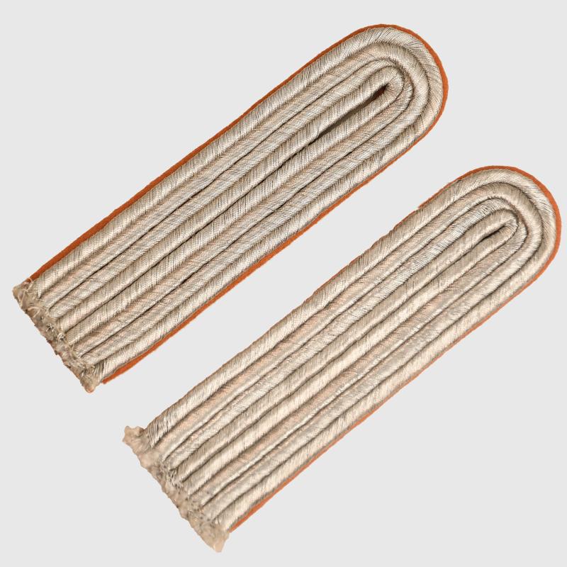
GERMAN WWII LUFTWAFFE SIGNALS SHOULDER BOARDS.
A mint unused set of stitch-in Luftwaffe Leutnant’s Signals Service shoulder boards. Bright silver exterior with brown underlay cloth. read more
50.00 GBP
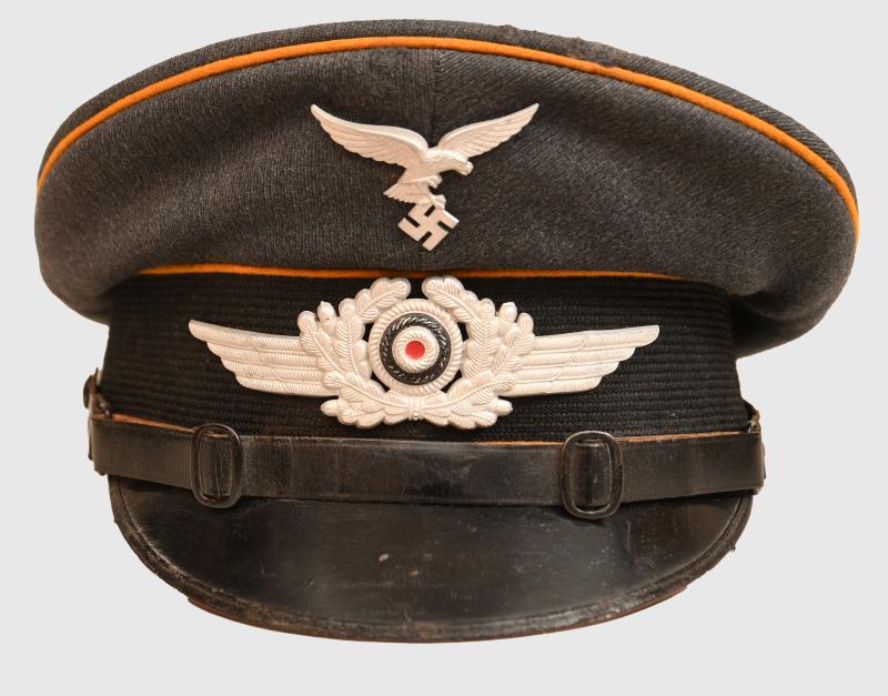
GERMAN WWII LUFTWAFFE FALLSCHIRMJAGER CAP.
Size 56½ officer quality produced visor cap in the semi tellerform. Yellow piping to the full circumference of the upper part of the cap and to the upper and lower sections of the mohair centre band. Standard double buckle oval strap. A nice matched set of droop tailed eagle and national cockade. The double edged ribbed peak intact to the exterior but to the interior of the peak the majority of... read more
895.00 GBP
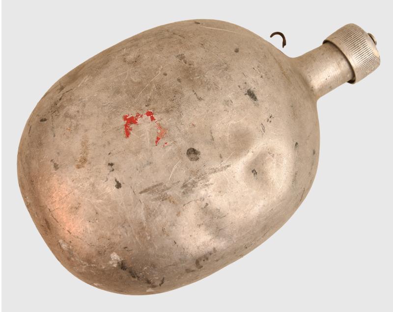
GERMAN WWII LUFTWAFFE SURVIVAL BOTTLE.
A large aluminium bottle measuring 25 x 11cm, dented overall. The bottle is from the Luftwaffe survival kit, which would contain fuel for starting fires needed in an emergency situation. Recently purchased from probably the best combat uniform and equipment collection in the United Kingdom comprising Army tropical, Waffen SS, Luftwaffe paratrooper and many other items of the same genre. The col... read more
80.00 GBP
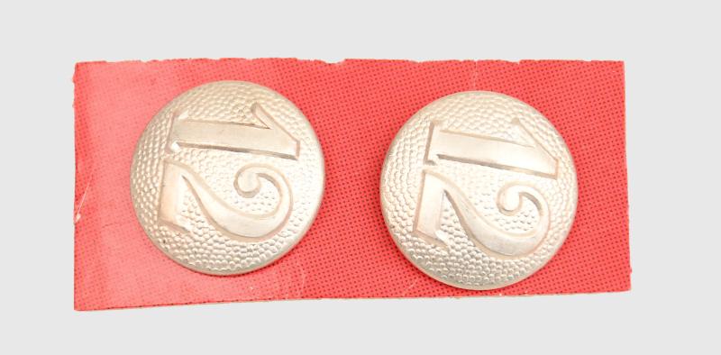
GERMAN WWII PARADE TUNIC EPAULETTE NUMBERED BUTTONS.
The numbered company buttons that were placed at the end of the shoulder board on parade tunics, all with extra-long shanks to pass through the depth of a shoulder board button hole, company 12. read more
20.00 GBP
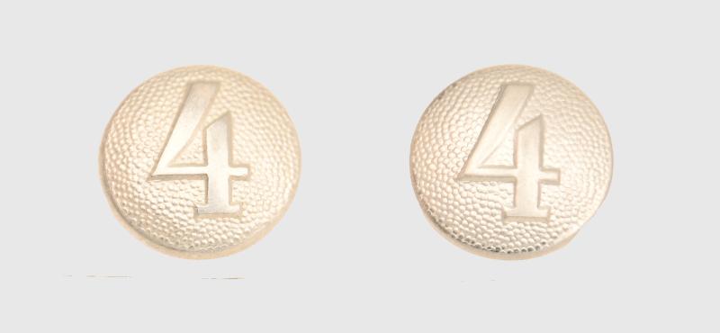
GERMAN WWII PARADE TUNIC EPAULETTE NUMBERED BUTTONS.
The numbered company buttons that were placed on the end of the shoulder board on parade tunics, all with extra-long shanks to pass through the depth of a shoulder board button hole, company 4. read more
20.00 GBP
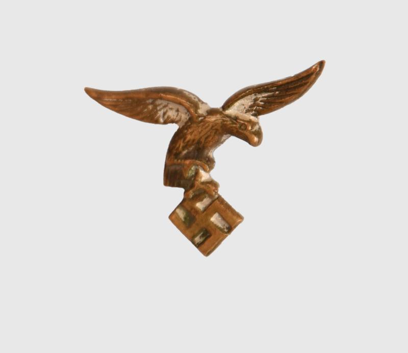
GERMAN WWII LUFTWAFFE LONG SERVICE MEDAL MOTIF.
The 20 mm wingspan early type eagle motif for fitting to a Luftwaffe long service medal bar. read more
20.00 GBP
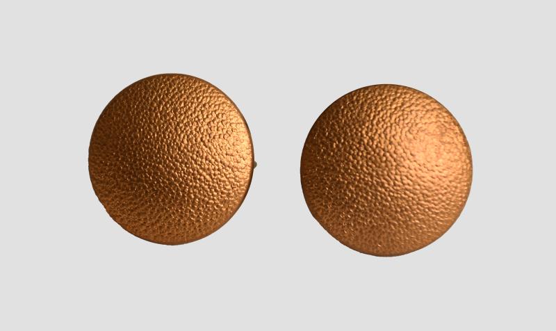
GERMAN WWII POLITICAL LEADER BELT RAMPS.
Two gilded belt support buttons for the rear of either a blouse or a political leaders tunic. Marked ‘RZM5/8’. read more
20.00 GBP
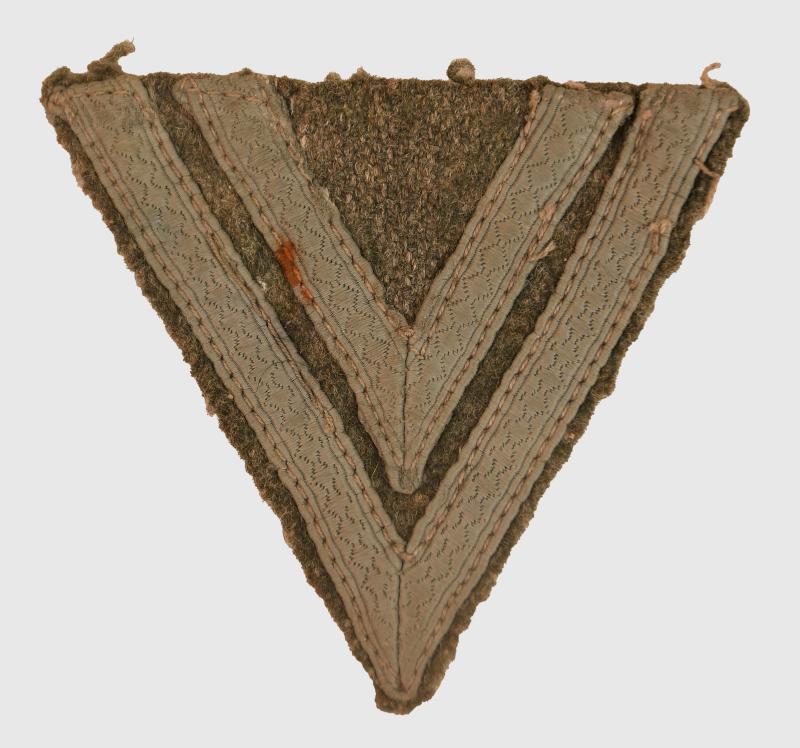
GERMAN WWII ARMY WARTIME OBERGEFREITER ARM PATCH.
Field grey backing with subdued grey lace. read more
30.00 GBP
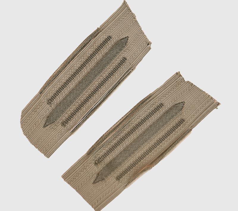
GERMAN WWII ARMY MOUSE GREY UNIVERSAL BEVO WOVEN COLLAR PATCHES.
Mint, unissued. Cut from roll. Correct left and right. read more
55.00 GBP