GERMAN WWI SOLDIERS AREA MAP.
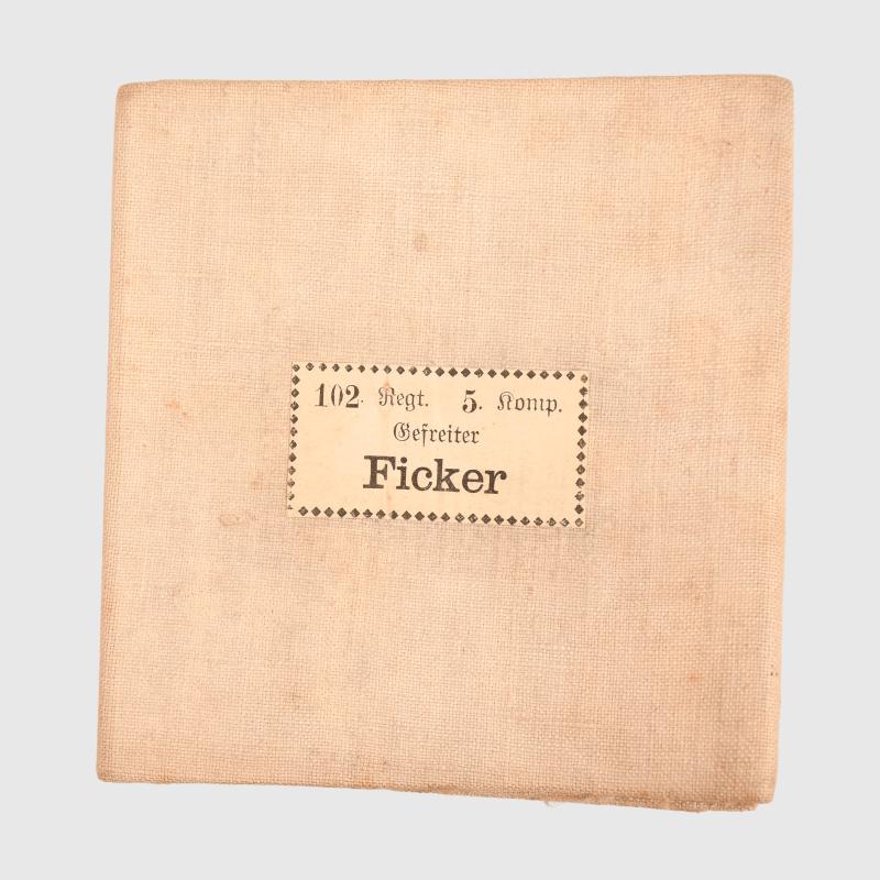
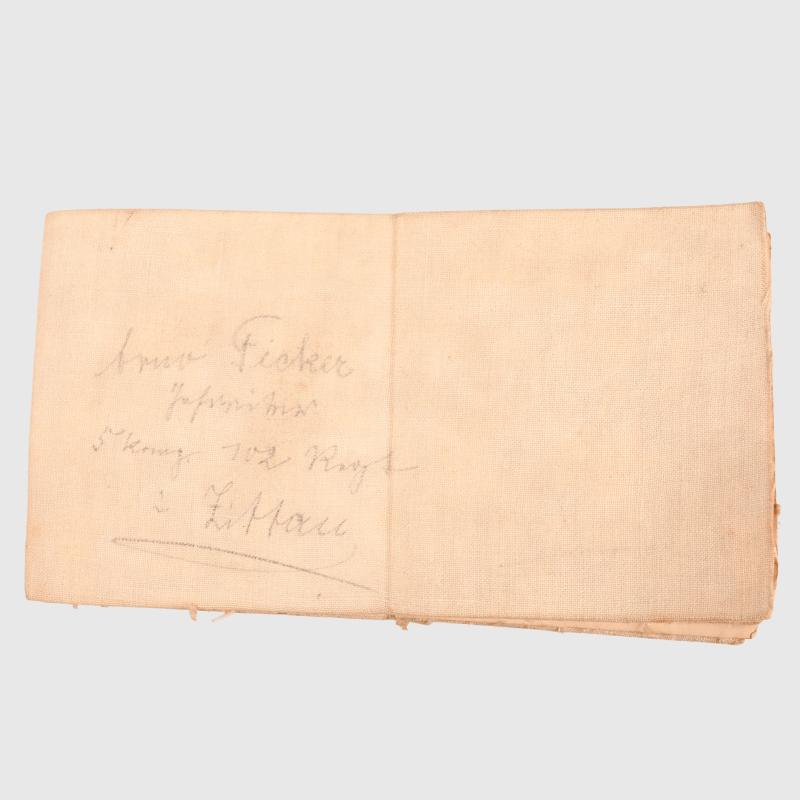
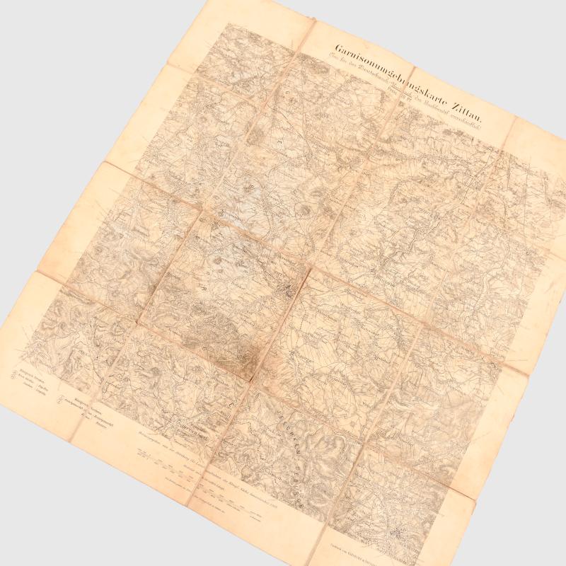
A canvas map, which unfolds, measuring 45 x 45cm of the area around the City of Zittau in Lower Saxony. The map is dated ‘1909’. Pasted to the outside of the map is one of the typical German soldiers identification labels ‘Gefreiter Ficker 102nd Regiment 5th Company’ these details are also hand applied next to the label.
Code: 96666
25.00 GBP